 /
/  /
/ Rancho Verde Story: Part 10 – How is Rancho Verde Developed?
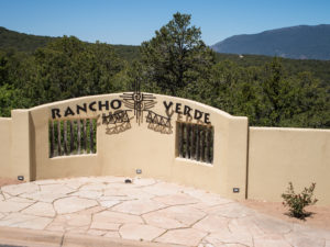
As the developers of Rancho Verde in the East Mountains near Tijeras, NM, we are frequently asked about the process we undergo to bring our view lots to market—here is the first part of the story.
The 589 acres of land which comprise Rancho Verde was acquired in the late 1990’s and, in consultation with the Bernalillo County Planning Commission in Albuquerque, a plan of residential sub-division of 255 lots was finalized. This plan permitted the phased development of Rancho Verde as market conditions dictated such that no further public consultation was necessary as each successive phase was undertaken. As of 2019, Rancho Verde has initiated 4 distinct phases with Phase I (51 lots), Phase II (23 lots) and Phase III (50 lots) being completely sold out. Phase IV (46 lots) consist of two parts, the first of which (31 lots) is currently offered for sale. Phase IV lots are located on gently sloping grassland with sweeping views of the Sandia Mountains and stunning sunrises and sunsets.
The process of creating a final sub-division plan complete with detailed roads requires care and diligence to achieve a blend of streets and lot building envelopes which are optimal. The location of roads is critical to ensure that they are economic to build and do not have any overly steep grades. Similarly, lots must contain a large enough buildable area such that a variety of house sizes and styles are practical to construct. How is this achieved? First an approximate lot layout for a new phase is drawn by our design Engineer (Phil Clark of Clark Consulting Engineering, ccealbq@aol.com) using aerial topographical maps which are produced by a department of the federal Government, the U.S. Geological Survey. Due to the heavy density of pinion and ponderosa pine which covers most of Rancho Verde lots, as well as open spaces, topographical maps produced from aerial photographs will not necessarily be entirely accurate. Thus, it is very important to check this initial lot layout against the actual conditions on the ground. This is achieved by having a Land Surveyor (Gary Gritsko of Alpha Pro Surveying LLC, www.alphaprosurveying.com) mark the tentative road centreline on the ground along with the placement of stakes along this centreline which identify the corners of the lots which front on this road. This marked centreline is then slowly walked by one of Rancho Verde’s development partners, Chris Green, a Civil Engineer, with extensive experience in road construction, lot layout and building envelope placement. Alterations to the tentative location of the road centreline are noted on a field copy of the drawing as each lot is investigated to ensure that the road in fact represents an optimal route and that a useful building envelope can be accommodated for each lot. It is at this stage that changes to the initial design are identified and communicated to the design Engineer for inclusion in the next layout. This next layout is then marked on the ground once again by the Land Surveyor followed by another on-site analysis by the development partner with any final adjustments (invariably minor at this stage) being incorporated in the final engineering design drawings for submission the Engineering Department of Bernalillo County.